
Last updated: 2026-10-19
Charlotte Map Poster
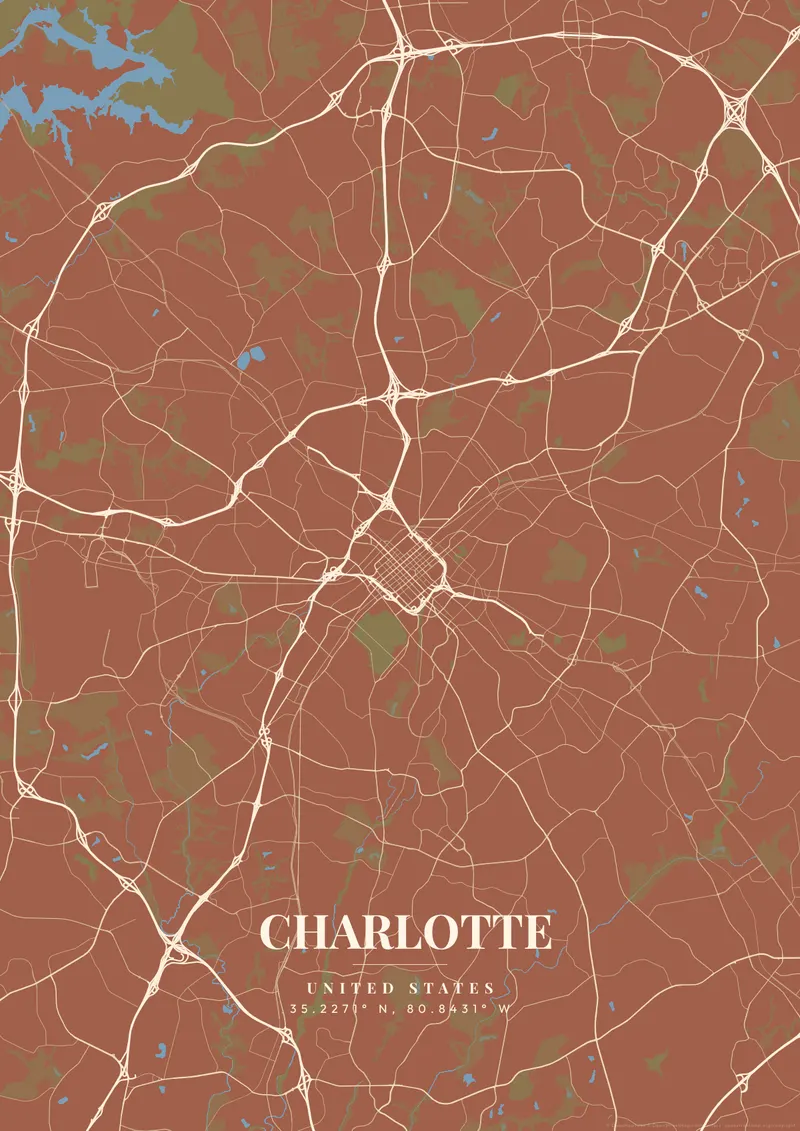
Design Your Charlotte PosterOrder this print
Free to design · Printed posters from $24.99, shipping included to 20 countries
What hits you first on Charlotte's map is the sheer, explosive sprawl, a city that barely existed a century ago now devours the Carolina Piedmont in every direction, hemmed only by the almost perfectly circular I-485 beltway that draws a 60-mile ring around the metro. Uptown, the tiny original grid, sits at the dead center where I-77 and I-85 collide in a tangled concrete knot. Little Sugar Creek carves a surprisingly wild, wooded ravine directly through the southern neighborhoods, while the colossal parallel runways of Charlotte Douglas International, the sixth-busiest airport in the world, stamp the western edge of the map like an industrial barcode.
Charlotte on the map
A custom map poster of Charlotte, United States turns a meaningful location into personalized wall art — completely free with MapPoster.
Charlotte is a banking town that never stops building. The four original wards radiate from Trade and Tryon Streets, an intersection that has anchored the city since 1768, and each ward now pulses with different energy: NoDa's gritty warehouse murals, South End's light-rail-fueled brewery explosion, the old-money canopy of Myers Park with its Olmsted-designed boulevards. Roaring Panthers midnight teal, polished Bank of America silver, or deep Carolina red-clay capture a city perpetually reinventing itself at full speed.
Printed and shipped to your door
Design your Charlotte map poster for free, then order it printed from the same editor. Posters print at 300 DPI on 170 gsm silk paper (A4 on 350 gsm card), and tracked shipping to 20 countries is included in every price. Each print is made to order within 3 business days, then usually arrives 3 to 6 business days after it ships (longer to Canada, Australia, Norway, New Zealand, Japan, Brazil and Mexico).
| Size | Dimensions | Poster |
|---|---|---|
| A4 | 8.3 × 11.7″ | $24.99 |
| 12 × 18″ | 30 × 46 cm | $34.99 |
| 16 × 20″ | 41 × 51 cm | $39.99 |
| 18 × 24″ | 46 × 61 cm | $44.99 |
| 12 × 12″ | 30 × 30 cm | $29.99 |
| 20 × 20″ | 50 × 50 cm | $44.99 |
Also framed (black, white or oak) from $79.99, on canvas from $69.99. Prices in USD, shipping included; checkout switches to EUR or GBP based on where you are. A print that arrives damaged is reprinted or refunded for free.
Frequently Asked Questions
Can I order a printed Charlotte map poster?
Yes. Design your Charlotte poster, then order it from the editor as a poster from $24.99, framed (black, white or oak) from $79.99, on canvas from $69.99. Prints are made at 300 DPI, tracked shipping to 20 countries is included in the price, and each print is made to order within 3 business days, then usually arrives 3 to 6 business days after it ships (longer to Canada, Australia, Norway, New Zealand, Japan, Brazil and Mexico).
Is the Charlotte map poster really free?
You can design and download a Charlotte map poster at 1080p with a small watermark at no cost. High-resolution versions (up to 7200px) without watermark are a one-time $6.99, and printed posters from $24.99 with shipping included. No subscription or account required.
What themes are available?
MapPoster has 50+ themes: 50+ artistic vector styles, including classic city maps with street names (Minimal White, Midnight Dark, Modern Voyager), plus OpenStreetMap and satellite map tiles. Artistic themes render every road and waterway in custom color palettes — from moody dark tones to bright pastels.
Can I customize the colors and style of my Charlotte poster?
Yes. Pick from 50+ themes, then adjust the color palette, text overlay, fonts, and layout. You can add a title, subtitle, date, and GPS coordinates for Charlotte. Everything is adjustable in the editor before you download.